


- Ben gets a Mac. A good friend of mine, Dean, works for Apple. (He designed the little antenna in your iPod which lets you connect to the internet.) As such, he gets a pretty ridiculous employee discount, which made the MacBook affordable. Now, I typically hate it when people gush about how much better the Mac operating system (OS) is than Windows. And, believe me, it's not that much better. In some ways it's actually worse---for example, you have very little control over the places where you save things, and the power manager is pretty sub par. iPhoto and iTunes are easy to use, but you can only store music and photos where Steve Jobs says you can store music and photos. The "sleep mode" isn't very good, and it runs the battery down pretty quickly. There are several pluses, however. OSX (the Mac operating system) is just a front end for Unix, which means that executing stuff from the command prompt and ssh-ing into other computers is pretty easy. The apps that people have built are also very nice. For example, there's a program called Papers, which builds a database of all of my scientific papers for easy browsing. All in all, it's better than your average laptop. The operating system is good, the components are good, and it's easy to replace simple things, like hard drives and RAM.
- The Trip Home from California. Bryanne and I drove from Palo Alto to Columbus in April, making a stop at the Grand Canyon for a spectacular sunrise and a plethora of Japanese tourists. The vistas were, of course, breathtaking:


 We also found other things of interest, including some dinosaur footprints in New Mexico:
- Bryanne and I Celebrate 1 Year. ...by going to the zoo!
 (It's been a good year, in my opinion.) The Columbus Zoo is great, and they have some very good exhibits. These fruit bats look kind of like my dog Lefty:
  I made a new friend, with a goat:
  I really like the moose exhibit, although the mooses were pretty inactive:
  Bryanne's favorite are the frogs:
- A Chorus Line comes to town. Bryanne's good friend Matt is the company manager for the national tour of "A Chorus Line". We'd seen the show in Detroit in January, but this time they came to Columbus. The production is very good. Typically the whole point of the chorus is to blend in, and be completely faceless, yet the show is about giving the chorus dancers some actual face. Some are looking for their first break, and some are looking to keep living their dream as a dancer, however low the pay, and however small their chances. Anyway, Matt and his husband Sandro were in town for the weekend, (which was our anniversary, too), and they joined us for drinks:


- Ben Dundee World Tour 2009. Currently, I am sitting in the Columbus airport, about to embark on a European Adventure. I am attending a conference in Hamburg, and it was actually cheaper for me to spend two weeks in Europe, than to spend just 5 days in Hamburg. I fly into Hamburg today, and fly out on the 15th. The conference runs from the 6-10, so I'll have a few days before hand to spend exploring the city, as well as a few days after the conference ends to take a side trip to Amsterdam. I will be sure and keep the blog updated with pictures and accounts of my exploits.
Showing posts with label driving. Show all posts
Showing posts with label driving. Show all posts
Wednesday, July 1, 2009
A Long Time Gone
I know I've been quite negligent in blogging---so many things have happened these past months. Here's a brief recap:


Friday, January 16, 2009
Back to California
I had originally planned on heading back to California via the Grand Canyon (northern Arizona), however, I spent too much time stopping and taking pictures, and so I missed my schedule by a couple of hours---instead of catching sunset, it would have been already dark. This is coupled with the fact that I caught quite a bit of snow starting at the New Mexico/Arizona border.
My father gave me a GPS device that he no longer used, so the following will be enhanced by longitude and latitude numbers! Click on the links, and you will go to Google maps---you can then look at satellite views or (to give you a sense of scales) the topological view.
Gila National Forrest.
I spent the night in Silver City, NM, after hitting US 180 off of I-10 at Las Cruces. The drive into Silver City was straight and flat, and the drive into the Gila National Forrest was coming into the foothills of the Rockies, officially the San Francisco Mountain Range. My first stop was the Alfred Leopold Vista (33° 11.014' N 108°49.739' W, Elev 5197 ft).
 I got out of the car and quickly realized how cold it was. I had to change into a sweatshirt as I took some pictures.


 After leaving the rest stop, I traveled a few miles and saw a turnoff for the "Catwalk Whitewater Picnic Ground" (33° 22.342' N 108°50.547' W, Elev. 5131 ft.) . Luckily, the water wasn't TOO white, as the park would have been rendered inaccessible:
 It was a very nice little picnic area, about six miles off the highway, with a small river running behind it.
 And, of course, I had to try my fancy camera out. This is a small aperture and long exposure picture of a piece of driftwood in the water, doctored just a bit with Picasa.
 US 180 continued through the mountains, with steep drop offs to one side, and sheer cliffs to the other. This is a turnoff at 33° 32.604' N 108°56.122' W, Elev. 5950 ft.

 Apache National Forest.
I began to climb further and further into the mountains, and at about 7000 feet it started to snow. And, even more beautifully, they hadn't scraped the highway. Now, my truck has 4WD and a manual shift option (which makes engine braking a breeze), so I had no trouble navigating the roads. In spite of my Texas licence plates, I do know what I'm doing when I'm driving in the snow, but there are a lot of idiots around. I pulled off of the interstate at a pass (33° 43.945' N 108°56.101' W, Elev. 7835 ft.) and took a few pics.


 I had to be quick, because it was a bout 25 °F degrees outside.
The Painted Desert and Petrified Forest.
As I came into Arizona, it was increasingly clear that I wouldn't make the Grand Canyon by sunset, so I decided instead to hit the Petrified Forest (34° 47.670' N 109°53.445' W, Elev. 5397 ft.).
 Now, I was imagining a forest of trees which were petrified, as the name implied. If the name of the park was truly descriptive, it would be called "A Forest Once Existed Here, but all the Trees Died and Fell Over, and now They're Rocks", but I imagine that it wouldn't have fit on the sign.
 I came into the park through the western entrance, and as I drove down the main road there were the fossilized remains of many ancient trees.
 The ranger at the entrance to the park assured me that it rarely snowed in the park, and getting to see it in such a state was a real treat. Maybe it was a treat for her, but because it was cloudy, it was hard to see all of the colors for which the park is famous.

 If I had to guess, I think that there used to be an ancient river which ran through this part of the country. The river deposited various sediments at various times, lending their colors to the sand.
 This is a formation called the "Teepees".
 I would have liked to have stayed a while longer, but it was getting late, so I had to move on.
 I stopped for gas once I got back on the interstate, and found this dinosaur in Holbrook, AZ (34° 56.272' N 110°07.900' W, Elev. 5268 ft.).
 Meteor Crater.
The final stop was Meteor Crater (35° 01.971' N 111°01.309' W, Elev. 5590 ft.), outside of Winslow, AZ (which is more than just a line in an Eagle's song). 50,000 years ago, a meteor hit the Arizona desert, leaving a crater about 1 mile in diameter.
 It's a little hard to appreciate the scale of this thing. I'd suggest going to Google via the link above and looking at the satellite picture of the crater. It is really impressive.
 To give you SOME idea of the scale, the rock I labeled in the picture is about the size of a house. That's the claim, according to the meteor people.
 This is a piece of the guilty party...
 All in all, I have to say I quite enjoyed my holiday. I got to see a good chunk of America, I learned some masonry, and I got to see Lefty. I also started a fossil collection, which (I'm sure) I'll post about in the future. There were TONS of fossils in Arizona, and even quite a few roadside shops which sold them. And, of course, Bryanne bought me a beautiful fossilized megalodon tooth for Christmas. But more on this later!
My father gave me a GPS device that he no longer used, so the following will be enhanced by longitude and latitude numbers! Click on the links, and you will go to Google maps---you can then look at satellite views or (to give you a sense of scales) the topological view.
Gila National Forrest.
I spent the night in Silver City, NM, after hitting US 180 off of I-10 at Las Cruces. The drive into Silver City was straight and flat, and the drive into the Gila National Forrest was coming into the foothills of the Rockies, officially the San Francisco Mountain Range. My first stop was the Alfred Leopold Vista (33° 11.014' N 108°49.739' W, Elev 5197 ft).
 I got out of the car and quickly realized how cold it was. I had to change into a sweatshirt as I took some pictures.

 After leaving the rest stop, I traveled a few miles and saw a turnoff for the "Catwalk Whitewater Picnic Ground" (33° 22.342' N 108°50.547' W, Elev. 5131 ft.) . Luckily, the water wasn't TOO white, as the park would have been rendered inaccessible:
 It was a very nice little picnic area, about six miles off the highway, with a small river running behind it.
 And, of course, I had to try my fancy camera out. This is a small aperture and long exposure picture of a piece of driftwood in the water, doctored just a bit with Picasa.
 US 180 continued through the mountains, with steep drop offs to one side, and sheer cliffs to the other. This is a turnoff at 33° 32.604' N 108°56.122' W, Elev. 5950 ft.
 Apache National Forest.
I began to climb further and further into the mountains, and at about 7000 feet it started to snow. And, even more beautifully, they hadn't scraped the highway. Now, my truck has 4WD and a manual shift option (which makes engine braking a breeze), so I had no trouble navigating the roads. In spite of my Texas licence plates, I do know what I'm doing when I'm driving in the snow, but there are a lot of idiots around. I pulled off of the interstate at a pass (33° 43.945' N 108°56.101' W, Elev. 7835 ft.) and took a few pics.


 I had to be quick, because it was a bout 25 °F degrees outside.
The Painted Desert and Petrified Forest.
As I came into Arizona, it was increasingly clear that I wouldn't make the Grand Canyon by sunset, so I decided instead to hit the Petrified Forest (34° 47.670' N 109°53.445' W, Elev. 5397 ft.).
 Now, I was imagining a forest of trees which were petrified, as the name implied. If the name of the park was truly descriptive, it would be called "A Forest Once Existed Here, but all the Trees Died and Fell Over, and now They're Rocks", but I imagine that it wouldn't have fit on the sign.
 I came into the park through the western entrance, and as I drove down the main road there were the fossilized remains of many ancient trees.
 The ranger at the entrance to the park assured me that it rarely snowed in the park, and getting to see it in such a state was a real treat. Maybe it was a treat for her, but because it was cloudy, it was hard to see all of the colors for which the park is famous.
 If I had to guess, I think that there used to be an ancient river which ran through this part of the country. The river deposited various sediments at various times, lending their colors to the sand.
 This is a formation called the "Teepees".
 I would have liked to have stayed a while longer, but it was getting late, so I had to move on.
 I stopped for gas once I got back on the interstate, and found this dinosaur in Holbrook, AZ (34° 56.272' N 110°07.900' W, Elev. 5268 ft.).
 Meteor Crater.
The final stop was Meteor Crater (35° 01.971' N 111°01.309' W, Elev. 5590 ft.), outside of Winslow, AZ (which is more than just a line in an Eagle's song). 50,000 years ago, a meteor hit the Arizona desert, leaving a crater about 1 mile in diameter.
 It's a little hard to appreciate the scale of this thing. I'd suggest going to Google via the link above and looking at the satellite picture of the crater. It is really impressive.
 To give you SOME idea of the scale, the rock I labeled in the picture is about the size of a house. That's the claim, according to the meteor people.
 This is a piece of the guilty party...
 All in all, I have to say I quite enjoyed my holiday. I got to see a good chunk of America, I learned some masonry, and I got to see Lefty. I also started a fossil collection, which (I'm sure) I'll post about in the future. There were TONS of fossils in Arizona, and even quite a few roadside shops which sold them. And, of course, Bryanne bought me a beautiful fossilized megalodon tooth for Christmas. But more on this later!
Monday, January 5, 2009
Driving Home: Sierra Nevada and Mojave Desert
If you know me, you know I'll never miss a chance to see a part of the country that I haven't seen before. I took this Christmas break as an opportunity to see a little bit of America---specifically, the southwest.
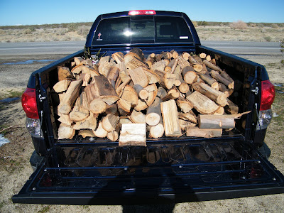
I set out from Palo Alto at 7 AM. My truck was laden with Eucalyptus firewood, which I was assured is a natural mosquito repellent, aside from smelling nice when it burns.
 My planned route took me down I-5, then east through the Sierra Nevada, to Bakersfield (of Merle Haggard fame) and Barstow where I picked up I-40. Then I turned south at Needles and traveled through the Mojave Desert on US 95 (which follows partly old US 66) to Blythe, where I picked up I-10 (for 1200 miles or so) into Houston.
Things were pretty uninteresting until I hit I-5, where I followed the Santa Cruz mountains south (just to my west).
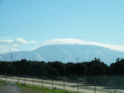 At Bakersfield, I turned more eastward, and came across the southern reaches of the Sierra Nevada.
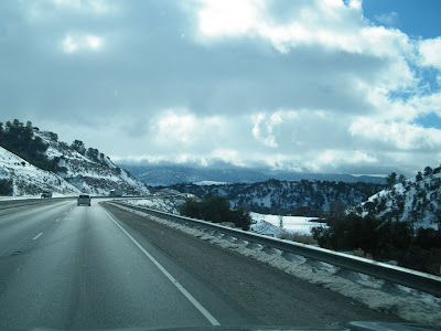
 There was snow, in places, and the temperature dropped to the mid 20's as I made the ascent.
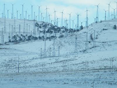
 A vicious cross wind powered wind turbines at the pass:
 Once I was trough the mountains, I pulled off the road to take in some of the scenery, and stretch my legs...
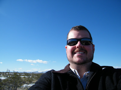
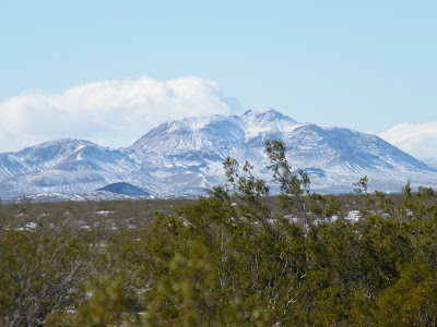 The weather was still a bit chilly, with a stiff west wind.
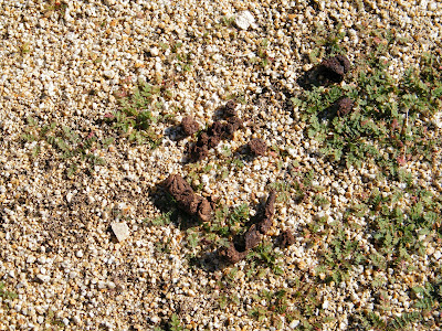
 And, of course, I found some random poop:
 The Sierra Nevada separate the fertile San Joaquin Valley from the Mojave Dessert---the mountains gave way to the vast flat, which stretched out for miles in front of me:

The road was straight and flat into Barstow...
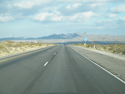 Once I made it to Needles, it was time to turn south, along the eastern edge of the Mojave Dessert.
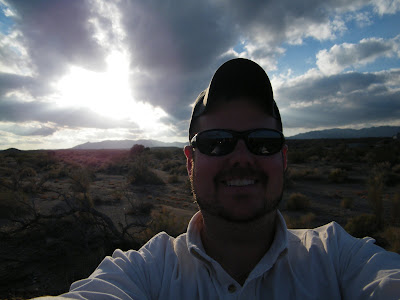 By this time, it was about 4 pm, and the sun was beginning to set over the desert.
 There were several dirt roads off into the desert---most likely service roads for the utility lines which ran alongside the highway---and around 4:45 or so I pulled onto one and drove about a mile or so off road. I hiked up a small rise about a quarter of a mile or so, and got comfortable for the sunset.
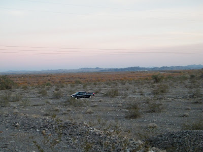
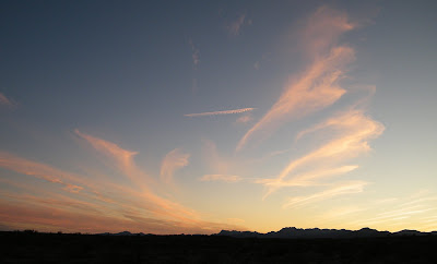
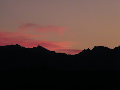
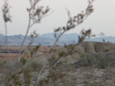 The sky exploded into oranges and reds, and my camera afforded me many different shutter speed and aperture settings. I got several nice shots as I watched the sun sink over the San Bernadino Mountains in the west.
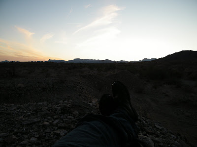
 Of course, then I had to find my way back to the road...
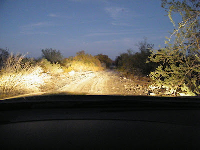 The rest of the drive into Texas was more or less uneventful. I got food poisoning from a Subway somewhere in Arizona, so I was in no mood to take many more pictures, however, the desert sunset more than made up for the explosive gastrointestinal blight, and I got some nice pictures on the return trip.
I set out from Palo Alto at 7 AM. My truck was laden with Eucalyptus firewood, which I was assured is a natural mosquito repellent, aside from smelling nice when it burns.
 My planned route took me down I-5, then east through the Sierra Nevada, to Bakersfield (of Merle Haggard fame) and Barstow where I picked up I-40. Then I turned south at Needles and traveled through the Mojave Desert on US 95 (which follows partly old US 66) to Blythe, where I picked up I-10 (for 1200 miles or so) into Houston.
Things were pretty uninteresting until I hit I-5, where I followed the Santa Cruz mountains south (just to my west).
 At Bakersfield, I turned more eastward, and came across the southern reaches of the Sierra Nevada.
 There was snow, in places, and the temperature dropped to the mid 20's as I made the ascent.
 A vicious cross wind powered wind turbines at the pass:
 Once I was trough the mountains, I pulled off the road to take in some of the scenery, and stretch my legs...
 The weather was still a bit chilly, with a stiff west wind.
 And, of course, I found some random poop:
 The Sierra Nevada separate the fertile San Joaquin Valley from the Mojave Dessert---the mountains gave way to the vast flat, which stretched out for miles in front of me:
The road was straight and flat into Barstow...
We were somewhere around Barstow, on the edge of the desert, when the drugs began to take hold... Suddenly, there was a terrible roar all around us, and the sky was full of what looked like huge bats, all swooping and screeching and diving around the car, and a voice was screaming "Holy Jesus. What are these goddamn animals?" (from Fear and Loathing in Las Vegas)
 Once I made it to Needles, it was time to turn south, along the eastern edge of the Mojave Dessert.
 By this time, it was about 4 pm, and the sun was beginning to set over the desert.
 There were several dirt roads off into the desert---most likely service roads for the utility lines which ran alongside the highway---and around 4:45 or so I pulled onto one and drove about a mile or so off road. I hiked up a small rise about a quarter of a mile or so, and got comfortable for the sunset.
 The sky exploded into oranges and reds, and my camera afforded me many different shutter speed and aperture settings. I got several nice shots as I watched the sun sink over the San Bernadino Mountains in the west.

 Of course, then I had to find my way back to the road...
 The rest of the drive into Texas was more or less uneventful. I got food poisoning from a Subway somewhere in Arizona, so I was in no mood to take many more pictures, however, the desert sunset more than made up for the explosive gastrointestinal blight, and I got some nice pictures on the return trip.
Subscribe to:
Posts (Atom)